Floating Solar Systems: How to Assess Reservoir Suitability
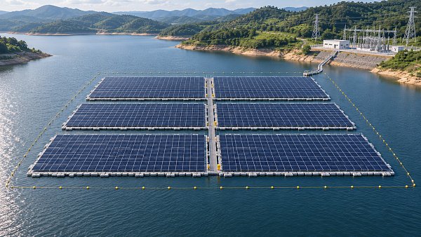
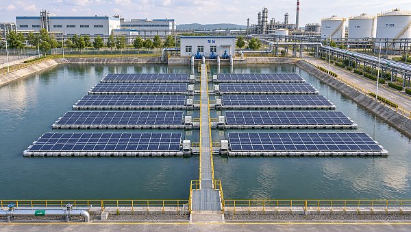
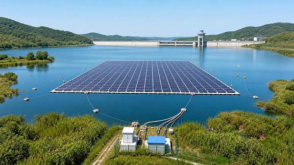
Floating solar systems can turn reservoirs into valuable renewable energy assets, but not every water body is suitable for development.
For project managers and engineering leads, early assessment must consider water-level fluctuations, bathymetry, wind and wave exposure, grid access, environmental constraints, and competing water uses.
This guide outlines the practical factors that shape reservoir suitability, helping teams identify risks, prioritize site investigations, and make better-informed decisions before committing to detailed design and investment.
The strongest candidate is a reservoir with sufficient usable area, manageable operating conditions, a credible grid connection, and an owner willing to accommodate long-term infrastructure.
Assess these conditions together. A sheltered site with excellent solar resources can still fail if water operations, permitting restrictions, or connection costs make the project impractical.
Start With a Reservoir Suitability Screening
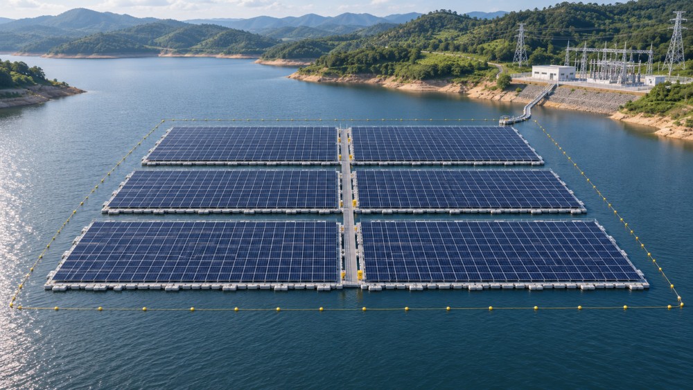
Begin with existing maps, reservoir operating records, satellite imagery, grid information, and discussions with the water authority. The goal is to identify constraints before commissioning expensive surveys.
Define the intended project capacity, expected connection point, development boundary, and operating life. These assumptions make site comparisons more useful and expose missing information early.
Screen for exclusion areas around spillways, intakes, navigation routes, public access points, protected habitats, and operational infrastructure. Confirm boundaries with the reservoir operator and relevant authorities.
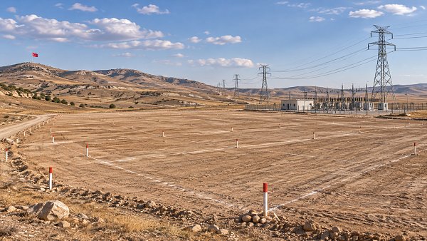
Then estimate the remaining area at both normal and low water levels. Treat this as a preliminary development envelope, subject to engineering, environmental, and permitting review.
Flag any issue that could prevent development outright, such as an unavailable connection, incompatible water operations, or a restriction that cannot reasonably be resolved.
For remaining sites, record uncertain costs and investigation priorities. A preliminary risk register should identify each issue, its owner, the evidence needed, and its decision deadline.
How Much Reservoir Area Is Actually Usable?
Total surface area is a poor proxy for project capacity. Floating arrays need clearance from infrastructure, shorelines, sensitive habitats, and areas required for reservoir operations.
Allow space for maintenance access, emergency response, cable routes, mooring arrangements, and separation between array blocks. Local rules or site agreements may impose additional setbacks.
Water levels change the shape of the available area. A location that looks suitable on a full reservoir may become shallow, exposed, or inaccessible during drawdown.
Use the proposed floating system’s layout and manufacturer specifications to translate usable area into indicative capacity. Include access gaps and mooring space instead of relying on module dimensions alone.
For an early illustration, if usable area is 20 hectares and a preliminary layout requires 1.5 hectares per megawatt, indicative capacity is approximately 13.3 MW.
That figure is a planning assumption, not a design standard. Actual density varies with module configuration, floating platform geometry, access requirements, water-level movement, and site restrictions.
Discuss acceptable coverage with the water authority and environmental regulators. There is no universal coverage percentage that establishes suitability for every reservoir.
Can the System Handle Water-Level Changes and Bathymetry?
Obtain historical water-level records, operating rules, seasonal patterns, and known extreme events. Ask whether future irrigation demand, drought planning, or operational changes could alter those patterns.
Assess the full credible operating range, including rapid drawdown and refill. The array must remain safely moored without grounding, overstressing lines, or obstructing reservoir infrastructure.
Survey bathymetry across the proposed array and mooring footprint. Water depth, bottom slope, submerged structures, and debris influence anchor selection, installation methods, and maintenance access.
Shallow margins may offer convenient construction access but create grounding risks. Deep water can increase mooring complexity and cost, particularly where long lines or specialized installation vessels are needed.
Investigate bottom conditions and shoreline geology before choosing anchors. Sediment, rock, embankments, and existing liners can each limit installation options or require specific engineering controls.
Where a dam or reservoir liner is involved, obtain the asset owner’s requirements early. Anchor installation, cable crossings, and shore works may require independent structural and safety review.
Request a preliminary mooring concept covering high and low water levels, line geometry, anchor locations, and expected movement. Final design requires site-specific loads and qualified engineering.
Are Wind, Waves, and Debris Within Design Limits?
A reservoir can be calm on most days yet experience severe storms. Assess wind direction, fetch, wave exposure, currents, and extreme weather over the project’s design life.
Use appropriate local records and engineering standards to establish design conditions. Where measurements are limited, identify uncertainty and commission further analysis before fixing the layout or equipment specification.
Long stretches of open water can generate significant waves. Shoreline shape, islands, and surrounding terrain may provide shelter, but their effects should be assessed rather than assumed.
Floating systems, connections, moorings, and electrical cables must work together under combined loading. Review fatigue, movement between components, and the consequences of an anchor or line failure.
Check for floating logs, vegetation, ice, sediment movement, and flood-borne debris. Depending on the site, protective measures may be needed, subject to water authority approval.
Ask suppliers to demonstrate suitability for the specified conditions and provide relevant design evidence. A platform reference project is useful only if its exposure and operating conditions are comparable.
Will the Project Interfere With Water Operations?
Reservoirs support services that may take priority over electricity generation. Drinking water supply, irrigation, hydropower, flood control, fisheries, and recreation can all affect project boundaries.
Meet the asset owner and operating team before selecting a preferred layout. Identify routine activities, emergency procedures, maintenance zones, and periods when access must remain unrestricted.
Confirm clearances from intakes, spillways, gates, monitoring stations, and navigation channels. Include future maintenance equipment and emergency access, not just normal operating footprints.
For drinking water reservoirs, investigate material requirements, contamination controls, maintenance procedures, and restrictions on vessels or personnel. Obtain written direction from the responsible water authority.
Where hydropower is present, shared infrastructure may offer opportunities, but confirm whether switchgear, transformers, protection systems, and connection agreements can accommodate additional generation.
Document operational responsibilities in the site agreement. The parties should define access rights, outage coordination, incident reporting, maintenance windows, and procedures for changing reservoir operations.
What Environmental and Permitting Work Is Needed?
Start by mapping applicable permits and the agencies responsible for water use, construction, electrical works, environmental protection, and grid connection. Requirements vary by jurisdiction and reservoir purpose.
Discuss the proposed footprint and investigation plan with regulators early. Their feedback can reveal seasonal survey requirements or protected features that materially affect the development schedule.
Potential environmental effects include changes to light penetration, water temperature, dissolved oxygen, aquatic habitats, bird activity, and shoreline disturbance. Outcomes depend on the site and array design.
Do not assume that reduced evaporation or improved water quality will occur at a useful scale. Model or measure relevant effects before including them in the investment case.
Assess construction impacts as well as operating impacts, including anchoring, vessel movements, cable installation, and work near sensitive habitats. Plan mitigation and monitoring where required.
Engage affected water users and communities early enough to influence the layout. Record concerns about access, visual effects, recreation, fisheries, and emergency procedures alongside regulatory requirements.
Build permit dependencies into the schedule. Surveys may need to cover particular seasons, while construction approval may depend on completed engineering, environmental studies, or land access agreements.
Is Grid Connection Commercially Viable?
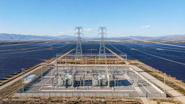
A suitable reservoir does not guarantee a viable power project. Identify the proposed point of interconnection, available network capacity, voltage level, and likely route for export cables.
Request preliminary feedback from the network operator on connection feasibility, application requirements, reinforcement needs, and expected timelines. Treat informal feedback as provisional until studies and agreements are complete.
Compare connection options using total delivered cost, including shoreline works, cable crossings, transformers, protection, communications, metering, and any network upgrades assigned to the project.
Review grid-code requirements for reactive power, voltage control, protection, curtailment, and remote dispatch. These can affect inverter selection, plant controls, and the final energy forecast.
Consider whether generation will serve an onsite load, a power purchase agreement, or wholesale sales. Each route changes the revenue model and the importance of export restrictions.
Storage may improve dispatch flexibility or reduce curtailment in some markets, but it adds capital, operating, and replacement costs. Evaluate it separately against the project’s actual revenue opportunities.
What Will Construction and Maintenance Require?
Identify assembly areas, launch points, vehicle routes, crane access, and temporary storage. A constrained shoreline can increase handling costs even when the water surface appears suitable.
Check water access across seasonal levels and construction periods. A launch method that works at full supply level may become impractical during drought or scheduled drawdown.
Plan electrical routing from floating equipment to shore, allowing for movement, water-level changes, mechanical protection, and inspection. The detailed design must follow applicable electrical and safety requirements.
Review corrosion exposure, ultraviolet resistance, biofouling, and material compatibility with water-use restrictions. Procurement specifications should address expected service life and documented maintenance requirements.
Develop an operations plan covering inspections, cleaning, vegetation and debris management, mooring checks, fault response, and safe isolation. Establish who provides boats, trained personnel, and rescue capability.
Ask insurers and potential lenders about evidence they expect for design verification, equipment quality, maintenance, and emergency response. Address material gaps before procurement commitments are made.
How Should Project Managers Compare Candidate Reservoirs?
Use a consistent scorecard after screening out sites with unresolved prohibitive constraints. Compare usable area, water-level risk, environmental sensitivity, grid access, construction access, and stakeholder support.
Separate verified facts from assumptions. For each score, record the source, confidence level, potential cost impact, and the investigation needed to improve confidence.
Estimate project economics using comparable assumptions for energy yield, installed cost, connection charges, operating expenses, financing, degradation, and expected revenue. Include schedule and contingency allowances.
Test sensitivities for grid upgrades, permitting delays, lower generation, mooring costs, and curtailment. A site with the highest theoretical capacity may deliver weaker returns under realistic assumptions.
Set decision gates: proceed to feasibility when critical risks appear manageable; investigate further when material uncertainty remains; pause when a constraint lacks a credible resolution.
Assign owners and deadlines to each open issue. The next investigation should target the uncertainty most likely to change the project decision, cost, or schedule.
Conclusion: Choose the Site That Can Be Delivered
Successful floating solar systems depend on more than available water surface. Reservoir operations, physical conditions, permits, grid access, and lifecycle costs must support the same project concept.
For project managers, the practical next step is to agree on screening criteria with the reservoir owner, grid operator, and technical team before advancing shortlisted sites to feasibility.
Questions about market trends? Contact Market Scope Live for deeper business insights.
We respect your privacy. Your information is strictly confidential.
Related News
 Solar PV SystemsSolar Mounting Structures Pricing: What Drives Costs for PV Projects?Solar mounting structures pricing depends on design, materials and site conditions. Learn how to compare bids, uncover hidden costs and make smarter PV project decisions.MORE+
 Solar PV SystemsIndustrial Parks in Vietnam: Comparing Locations, Costs and InfrastructureCompare industrial parks in Vietnam by location, costs, logistics and power infrastructure. Discover how to shortlist the right site for your business.MORE+
 Solar PV SystemsFloating Solar Systems: How to Assess Reservoir SuitabilityFloating solar systems need the right reservoir. Discover how to assess water levels, grid access, environmental risks, and costs before investing.MORE+
 Solar PV SystemsSmart Solar Tracking Systems: How to Evaluate Energy Gains and Site SuitabilityExplore how smart solar tracking systems can boost energy yield. Compare site suitability, lifecycle costs, and fixed-tilt alternatives to make a confident investment decision.MORE+
 Solar PV SystemsFloating Solar Projects on Industrial Ponds: How to Assess Site SuitabilityAssess floating solar projects on industrial ponds with a practical guide to water levels, mooring, electrical connections, and site risks.MORE+
 Solar PV SystemsTurkey Allocates 785 MW of Grid Capacity in YEKA Solar TenderTurkey's YEKA solar tender allocates 785 MW of grid capacity across 11 sites. Explore what the results could mean for developers and suppliers.MORE+
 Solar PV SystemsChoosing String Inverters for Solar PV: Sizing, MPPT and ShadingChoose string inverters with confidence. Compare DC-to-AC sizing, MPPT allocation and shading impacts to improve solar PV performance.MORE+
 Solar PV SystemsChoosing Solar Racking Systems for Rooftops: Roof Type and Load FactorsChoosing solar racking systems for rooftops? Compare roof types, load factors and mounting options to plan a safer, more reliable installation.MORE+
 Solar PV SystemsSolar Tracking System Pricing: What to Include in a Project BudgetUnderstand solar tracking systems pricing and build a reliable project budget. Compare supplier quotes, uncover hidden costs, and assess long-term value.MORE+
 Solar PV SystemsChina Adds 110.83 GW of Solar in First Nine Months of 2026, Down 53.9%China solar additions reportedly fell 53.9% to 110.83 GW in January–September 2026. Explore pricing reform impacts and practical insights for project planning and procurement.MORE+
 Solar PV SystemsHow to Vet Solar Equipment Manufacturers: Quality, Warranties, and Lead TimesSearching “renewable equipment manufacturers solar”? Learn how to verify quality, compare warranties, and validate lead times to shortlist reliable suppliers and reduce project risk.MORE+
 Solar PV SystemsCommercial Rooftop Solar in India: How to Calculate Costs and PaybackCommercial rooftop solar India guide: calculate installation costs, estimate realistic savings and payback, and compare EPC quotes to make a smarter business investment.MORE+
 Solar PV SystemsSolar EPC Contractor Pricing: How to Compare Quotes and Spot ExclusionsCompare solar EPC contractor pricing with confidence. Learn how to spot exclusions, assess allowances, and uncover hidden costs before choosing the right quote for your project.MORE+
 Solar PV SystemsHow to Assess Site and Grid Feasibility for Solar Power Generation ProjectsAssess solar power generation projects with practical guidance on site suitability, grid capacity, connection costs, and curtailment risks. Make smarter investment decisions before committing capital.MORE+
 Solar PV SystemsPepco Approves ConnectDER Meter Adapters for Solar, Storage and EV Charging in D.C.Pepco approves ConnectDER meter adapters in D.C. for solar, storage and EV charging. Discover how meter-level connections could simplify installation and reduce costs.MORE+
 Solar PV SystemsTOPCon Photovoltaic Modules: Selection Criteria for High-Temperature Utility ProjectsTOPCon photovoltaic modules for hot-climate utility projects: compare temperature performance, bifacial yield, reliability, and electrical compatibility for stronger lifetime returns.MORE+
 Solar PV SystemsHow to Verify PV Module Supplier Capability Before Utility-Scale ProcurementVerify PV module supplier capability before utility-scale procurement with a practical checklist for factory audits, certifications, traceability, capacity, warranties, and risk control.MORE+
 Solar PV SystemsHow to Size Solar Power Generation Systems for Commercial Sites and Peak LoadsSolar power generation systems for commercial sites: learn to size PV for load profiles, peak demand, grid limits, storage, and future growth.MORE+
 Solar PV SystemsSolar Farm Construction: How to Plan Site, Grid Access, and Build RiskSolar farm construction insights for smarter site planning, grid access, procurement, and build-risk control—helping projects reach energization with confidence.MORE+
 Solar PV SystemsWhich Solar Inverter Certifications Are Mandatory in North America?What certifications are mandatory for solar inverters in North American markets? Explore UL 1741, IEEE 1547, CSA rules, and utility approval essentials.MORE+
 Solar PV SystemsWhat Is the Typical Payback Period for Commercial Solar PV in 2026?What is the typical payback period for a commercial solar PV installation in 2026? Explore the key cost, tariff, incentive, and sizing factors that shape returns.MORE+
 Solar PV SystemsWhat Causes Voltage Fluctuations When Large PV Plants Connect to Weak Grids?What causes voltage fluctuation when large solar PV plants connect to weak grids? Explore root causes, diagnostics, and proven mitigation strategies.MORE+
 Solar PV SystemsWhat Determines Solar Power Generation Efficiency in Commercial PV Projects?Solar power generation efficiency in commercial PV projects depends on more than module ratings—explore site resource, design, grid, and O&M factors that maximize long-term energy yield.MORE+
 Solar PV SystemsCommercial Rooftop Solar Financing: Comparing Loans, Leases, and PPAsCommercial rooftop solar financing explained: compare loans, leases, and PPAs to choose the right balance of savings, ownership, flexibility, and risk.MORE+
 Solar PV SystemsPV Bid Evaluation: How to Compare EPC Proposals Beyond the Lowest PricePV bid evaluation helps procurement teams compare EPC proposals beyond price—assess scope, energy yield, schedule, supply chain, warranties, and contract risk to protect long-term solar asset value.MORE+
 Solar PV SystemsWhat Environmental Permits Are Needed for Floating Solar on Reservoirs?What environmental permits are needed for floating solar on reservoirs? Explore water-use, EIA, shoreline, biodiversity, and water-quality approvals for smarter FPV development.MORE+
 Solar PV SystemsHow Long Does Utility-Scale Solar Grid Approval Take in 2026?How long does utility scale solar grid approval typically take in 2026? Explore timelines, queue risks, upgrade costs, and strategies to accelerate project delivery.MORE+
 Solar PV SystemsDo Agrivoltaic Projects Significantly Reduce Crop Yields in Hot Climates?Do agrivoltaic projects reduce crop yield significantly in hot climates? Explore how smart shade, crop selection, irrigation, and solar design can protect yields, improve quality, and strengthen dual-use land value.MORE+
 Solar PV SystemsHow Predictive Solar Plant O&M Reduces Downtime and Protects Energy YieldPredictive solar plant O&M helps cut downtime, detect faults early, prioritize repairs, and protect long-term energy yield with actionable data insights.MORE+
 Solar PV SystemsWhat Grid Connection Requirements Apply to Solar-Powered EV Charging?Solar farm grid connection requirements for EV charging explained: explore import/export limits, protection, storage, grid codes, and smart design strategies.MORE+
 Solar PV SystemsHow Much Solar Farm Capacity Is Needed to Offset Charging Demand in 2026?How to plan solar farm capacity to offset charging station demand in 2026? Explore sizing formulas, grid limits, storage strategies, and scalable EV charging solutions.MORE+
 Solar PV SystemsWhat Are the Actual Maintenance Costs of Solar Canopy Inverters?What are the real maintenance costs of solar inverters on charging canopies? Explore service, monitoring, repairs, downtime, and smarter lifecycle budgeting.MORE+
 Solar PV SystemsWhat Should Building Owners Evaluate Before Installing Rooftop Solar Photovoltaic?Rooftop solar photovoltaic planning starts with the right questions. Learn how to assess roof strength, load profile, grid limits, permits, and ROI before investing.MORE+
 Solar PV SystemsChina’s First Compute-Power and Green Power Direct Supply Project Enters OperationChina’s first compute-power and green power direct supply project begins operation, linking 500 MW solar power with data center demand for higher efficiency and stronger green energy credibility.MORE+
 Solar PV SystemsWhat Should Be Included in Solar Plant Engineering Design for Utility-Scale Projects?Solar plant engineering design for utility-scale projects should cover site constraints, layout, electrical systems, grid compliance, safety, and O&M—see what a complete, bankable design package must include.MORE+
 Solar PV SystemsUSTR Opens CVD Review on Chinese PV ModulesUSTR opens a CVD review on Chinese PV modules, raising questions over tariffs, sourcing, and Southeast Asia supply chains. See what importers and developers should watch now.MORE+
 Solar PV SystemsHow to Evaluate Rooftop Solar EPC Contractors for Commercial PV ProjectsRooftop solar EPC contractors can make or break commercial PV success. Learn how to compare engineering, grid, safety, scope, and risk control before choosing the right partner.MORE+
 Solar PV SystemsFixed Tilt Solar Racking: How to Evaluate Wind Load, Site Layout, and ROIFixed tilt solar racking guide: learn how to assess wind load, site layout, grading, foundations, and ROI to avoid hidden costs and choose a smarter solar structure.MORE+
 Solar PV SystemsHow to Choose Solar Modules for Commercial and Industrial PV Projects?Solar modules for C&I PV projects: learn how to compare efficiency, temperature performance, site suitability, warranty, and bankability to choose the right solution with confidence.MORE+
 Solar PV SystemsUSTR Extends Tariff Relief for Chinese PV ModulesUSTR Extends Tariff Relief for Chinese PV Modules through Dec. 31, 2026. See how the update affects solar procurement costs, project timelines, compliance, and U.S. market planning.MORE+